Sunday, October 21, 2012

Edge of the Wild
Travels in Western Newfoundland, Part 6
Lobster Cove Head Lighthouse

In 1889, the people of Rocky Harbour were each contributing one pint of oil every week in order to keep a lamp lit in a fisherman's house as a navigational beacon at the entrance to Boone Bay.  The bay was well traveled even then, with several communities along two fjords that split from the bay further inland.  The people expressed concern to the government regarding the lack of a proper beacon and at last, in 1898, the Lobster Cove Head Lighthouse began operation.  From that year until 1970 there have only been three lighthouse keepers, the last leaving shortly after the light was automated in 1969.  It still serves each night, on a picturesque promontory above the bay, and is now also a historic site in Gros Morne National Park, complete with a museum and picnic area.

Lobster Cove Head Lighthouse from Rocky Harbour
 One evening, while staying in the town of Rocky Harbour, we trundled down the short winding road to the lighthouse across the bay from the town, to catch the sunset light.  The weather seemed odd, with low clouds over the lighthouse, town and mountains behind us, but with a clear sky over the water to the west that allowed the sunset to light up the underside of the clouds in bright purples and oranges.  (Note to photographers: because the water is to the west it's difficult to get a pleasing shot of the lighthouse lit by sunset light without being in a boat!  This would likely be a magnificent location for dawn photos.  Sadly the weather was often uncooperative in the early mornings for sunrises.)

As the sun drew near the horizon a stunning display of bizarre weather unfolded before our eyes.  First the clouds turned almost flourescent pink and the lighthouse turned on.  A number of people sat on the rocks below the tower and, making the best of the situation, I started to shoot a series of close-in shots of the lighthouse, cropping out the nearby people.


To my surprise, after a time, people on the rocks suddenly began to turn around and point toward me, not far away, my tripod planted in a small clearing.  This seemed a little unusual and I felt a bit self-concious and began to pack up to move to a different spot.  As I turned around I realized the people weren't pointing and staring at me.  A huge storm had rumbled in over the mountains to the east, and, combined with the light of the sun at the horizon, was creating the most enormous rainbow I've ever seen.

The closer the sun is to the horizon, the larger the rainbow, and at this moment the sun was almost touching the horizon. The rainbow grew brighter and brighter, and then a fainter, but still clear second, rainbow appeared, outside the first, until two full arcs stood above the heads of the astonished onlookers, with the background lit with the magic light of sunset, and the oncoming storm in the background.  I stumbled frantically up an embankment where I could get a clear shot, but a pleasing composition was elusive (as seen below!)  Still, it was a remarkable moment.
 

A few moments later, I turned around to see the sun slipping below the horizon.


As the sun faded a clap of thunder and spattering rain announced the onset of two days of rain, but I did have another evening at the lighthouse later, with a much less dramatic, but still beautiful evening.

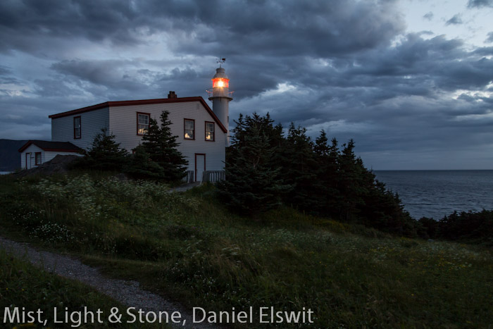
Lobster Cove Head Lighthouse at about 10:30 at night.
Next... Western Brook Pond, and a boat ride down an ancient fjord, now a land-locked lake.

Sunday, October 7, 2012

Edge of the Wild
Travels in Western Newfoundland, Part 5
The Tablelands

 Once upon a time, two continents crashed together.  For millions of years, what would one day become Europe and North America slowly drifted toward each other.  A range of undersea volcanoes arose in the ancient ocean between them, and as the two continents came together the volcanoes were crushed between the two land masses.  The force of the collision pushed up a mighty mountain range, perhaps as high as the Himalayas, which later became known as the Appalachians.  It also pushed up gigantic areas of rock from deep beneath the crust of the earth, mantle rock that is not normally ever seen on the surface.  Then the two continents broke apart and drifted away from each other.  But they didn't break at exactly the same place that they came together.

Protected within Gros Morne National Park in Newfoundland, is a geological feature unique on earth.  Over a few short miles it is possible to walk or drive across rock that was once part of a different continent, across the remains of ancient undersea volcanoes, to a mountain of mantle rock.  The mantle rock from deep in the earth is low in nutrients and high in certain minerals that make it toxic to most plant life and so, in the midst of a place steeped in the most vibrant greens and blues, lies a barren, flat-topped mountain about 2,300 feet high and encompassing about 50 square miles, that is an orange desert.  This stark, Mars-like landscape is the Tablelands.

The Tablelands trail
 Most of the Tablelands are a trail-less wilderness, accessible only to hardy backcountry hikers, but there is one 2.5 mile trail, out and back, that leads into a valley on the northern side, along a stream, with a parking area along route 431 just past Woody Point.  The views from this trail are excellent and provide a good flavor of this strange, otherworldly place.  On the day we visited, in early July, snow still lingered along the ridge above us, and fog alternately obscured and revealed the top of the plateau.  It was late afternoon and the muted sun and orange ground made the scene seem to softly glow.

Evening at the Tablelands
 Athough the rock is toxic to most plant life, some hardy things do grow here.  I found the shapes of these gnarled and twisted plants clinging to poisonous rock to be an irresistable photographic subject, and came back with over 100 shots of the flora of this area alone!  Occasional small purple flowers incongruously decorated the landscape a few yards into the barren area, making for interesting photographic contrasts.

Purple flowers at the edge of the Tablelands

Only the hardiest of plants manage to eke out an existance here!
 High shutter speeds were a necessity for flora shots though, as the wind howled off the heights and funneled down the valley into our faces at probably 50mph or more.  My normally stalwart tripod was nearly useless in the wind and I found that only by keeping it low to the ground could I really take advantage of it.  (This became a common situation as we went further north on the Peninsula.)

Adventureous hikers (or photographers) who venture to the top of the Tablelands are warned to prepare for extreme conditions - high winds, heavy fog, freezing weather, and sudden changes in temperature.  Although we very much wanted to stay longer in the area, and perhaps take a brief foray to the top, the sun was low in the sky and to our surprise we discovered that it was past 8:30pm!  We still hadn't gotten used to the long northern days.  With regret we started on the 40 mile drive back to our cabin and a late dinner.

Next time...  Crazy weather at a lighthouse.